In today’s fast-paced world, it has become increasingly important for industries to embrace technological advancements to improve efficiency and reduce risk. Drone integration and asset management software are two such technologies that are revolutionizing how we collect and analyze data. This article will explore the concept of a digital twin and how it changes our collaboration and communication.
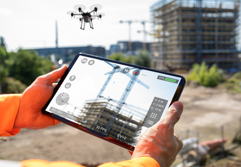
A digital twin is a digital representation of a physical asset, which allows for the collection and analysis of data collaboratively and efficiently. This concept has been applied to various industries, such as construction, engineering, and infrastructure management. A digital twin can provide a comprehensive view of the asset using images from drones or cameras, ground control, QR codes, and asset information.
The data collection process for a digital twin can be done through various methods, such as preplanned drone missions, manual missions, AI missions, or images with 70-80% overlap. Because of the number of pixels collected, measurements are more accurate than those using a through-thickness UT measurement or caliper. The closer the drone is, the higher the resolution, which allows for creating a model from a phone camera.
The modeling process allows all asset information to be on the model, not a paper report. This makes it easier to compare written reports, as Mapquest vs. Google Maps being modeling. Using AI allows for the significant ingestion of trained data, finding patterns, and making decisions. The accuracy has been about 80-90%, which is better than a human can do unless given unlimited time.
One of the key benefits of a digital twin is the ability to conduct virtual field visits for the entire team and client. This allows for real-time collaboration and the ability to view and analyze the asset remotely. The workflow for a digital twin typically involves data collection, creating a digital twin, field inspection, rehabilitation design and plans, and construction. Notes for field inspection are made directly on the digital twin and not reported and attempting to identify the location. 3D photo navigation allows you to click the area, and all photos of that area are available.
Mixed reality inspections using Bentley—Microsoft Hololens 2 have made the process even more efficient. The model can be brought up, and the team collaborating can all access the field inspection. This replaces rope access, under-bridge access, safety, better accessibility, and unlimited access.
To ensure that the benefits of a digital twin are maximized, a training program is required to build the ability for Part 107 for drone license and internal training for creating models and how to share them and navigate them. The information quality is improved using drone modeling, which reduces risk and significant safety improvements, such as increased quality and quantity of data, cost savings from reduced hours, and equipment for data collection.
The industry implications of drone integration and asset management software are significant. They require a project workflow shift where data is king, engineer/inspector qualifications are changing, and robotics, AI, and machine learning are embraced. It is essential to abandon traditional methods, as AI and automation will change work categories. The use of AU to address staffing shortages is necessary. Brains vs brawn and inclusivity are the new themes.
In conclusion, drone integration and asset management software are changing how we collect, analyze, and communicate data. The benefits of a digital twin, such as improved efficiency, reduced risk, and increased safety, are significant. By embracing these technological advancements, we can improve the quality and quantity of data and streamline workflows, resulting in cost savings and improved results. Drone Integration and integration into Assesst management software.
Barritt Lovelace, P.E, Collins Engineers.